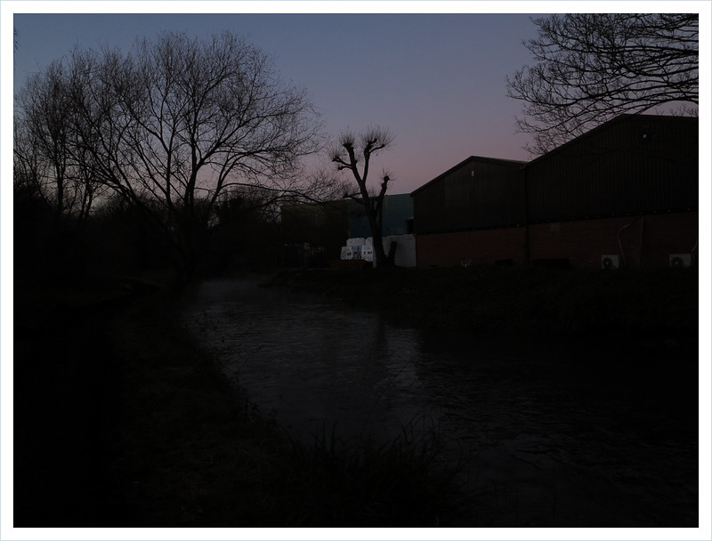
Enfield Lock to Waltham Cross via Gunpowder Park, Cornmill Stream, and Waltham Abbey; 4 January 2015

Waltham Abbey, Essex

On Sunday, 4 January 2015, we went for a walk. The weather was dry, but dull and overcast. We planned to walk from Enfield Lock station to Epping, but exceptionally muddy conditions slowed us down and we were forced to turn back to Waltham Abbey and finally Waltham Cross.

We began by taking a 41 bus to Tottenham Hale station and from there a train to Enfield Lock. Exiting the station, we headed south down Bradley Road, then turned east along the footpath by Turkey Brook to the River Lea and Enfield Lock itself. Having passed the semi-derelict shell of Rifles (formerly the Royal Small Arms Tavern), we crossed a footbridge leading into Enfield Island Village, a recent housing development built on the site of the Royal Small Arms Factory, which closed in 1988.

After briefly following a tarmac path north under a line of electricity pylons, we turned east again between houses, crossed the River Lee Flood Relief Channel, and reached the entrance to Gunpowder Park. The latter was until the 1980s part of a military research facility (Quinton Hill Farm) but has now been redeveloped into a pleasant tract of rough grassland with some artificial-looking hillocks – perhaps traces of the former use of the land for testing explosives.

At the north-eastern corner of Gunpowder Park we emerged on to Sewardstone Road and walked a short distance north to a roundabout, where we intended to turn east along Dowding Way (A121), the most direct route to a footbridge over the M25; however, the road – apparently built fairly recently following the closure of Quinton Hill – had no pedestrian footway and the traffic seemed to be racing along rather too fast for our liking. Cautiously, we made a detour instead up the northern continuation of Sewardstone Road and approached the footbridge via Lodge Lane.

On the other side of the motorway, we passed through an area of suburban housing, part of the town of Waltham Abbey, and eventually reached a footpath by Cobbins Brook, a tributary of the Lea. According to Wikipedia (but not mentioned, as far as I can see, in any historical source published online), a ‘local legend’ has it that Queen Boudica used hemlock gathered from the banks of the brook to poison herself following her army’s defeat by the Romans at the Battle of Watling Street in c.60–61 CE. It’s the kind of story I like, but the current view is that the battle took place far away from here – in the Midlands – so it seems rather implausible.

At Honey Lane, we had to leave the brook and continue our progress via the oddly named Stonyshotts. This suburban street is not shown on an Ordnance Survey map of c.1893–1913, at which time the locality, with the exception of Honey Lane, was still fields. Although there seem to be many different interpretations of the meaning of shott in British place names, one is that it comes from the Old English sceot, meaning a steep slope (in this case, perhaps, a stony slope) and it occurs to me that the road, which does wind noticeably downhill to the brook, then uphill again, might be named after one of the fields it was built on. It doesn’t sound like a name concocted in the mid twentieth century, which is when the houses on the street appear to date from..

After skirting the grounds of a school and making our way through more residential streets, we reached Upshire Road. Here, we turned up Pick Hill and, where this bent sharply to the right, took a footpath leading north-west.. After a short distance, we encountered Cobbins Brook for the third time, crossing it via a footbridge to enter a boggy field.

At this point, our progress uphill towards Dallance Farm became painfully slow. There was so much mud that getting anywhere near Epping before dark was clearly impossible. Instead, having finally arrived at the farm, we elected to turn west towards the Crooked Mile (B194) and follow the Cornmill Stream into Waltham Abbey.

At first, the footpath west from Galleyhill Road took us uphill across relatively dry fields, but when we joined Claygate Lane and began to descend towards the Lea, the track – much used by people on horseback – became a quagmire. We were relieved to reach the Crooked Mile at dusk, but much worse was to come.

Rejecting the dark, dangerously twisting road in favour of a path leading into the Lea Valley Park, we found our way to the Cornmill Stream, an artificial channel branching off from the Lea and thought to have been constructed in the eleventh century to provide water for the mills owned by Waltham Abbey.

The path by the stream was easy to follow, despite the lack of light, but it was atrociously muddy. With great difficulty we slithered and stumbled our way in almost total darkness the final half mile or so to the abbey, passing the (reputed) grave of Harold Godwinson before emerging on to Highbridge Street, from where we walked by road to Waltham Cross bus station and took a 217 back to Turnpike Lane.

Belvedere to Slade Green via Erith and Crayford Ness; 31 December 2014

Erith, London

On New Year’s Eve we went for a walk. With the weather dry and intermittently sunny, but rather cold, we decided to walk from Belvedere to Erith, and then round Crayford Ness and up Dartford Creek, finishing at Slade Green station.

We started by taking a 141 bus to London Bridge, and then a train to Belvedere (until 1965 in Kent, but since then part of the London Borough of Bexley). The suburban district takes its name from Belvedere House, an eighteenth-century mansion that stood on a hill near here overlooking the Thames (‘belvedere’ comes from Italian, meaning ‘beautiful view’).

From Belvedere station we headed north up Norman Road to Eastern Way (A2016) and the entrance to the oddly named Isis Reach industrial park, where a succession of large trucks was entering and leaving an ASDA distribution centre. We crossed the road and passed through a kissing gate into the Crossness Nature Reserve, a remnant of the extensive Erith Marshes, now largely built-up.

Crossing muddy fields, some with horses in them, we eventually reached the river, where we joined the Thames Path, eastwards towards Erith. This section of our walk, by the mainly industrial or semi-derelict riverside, was familiar from several previous trips, but on those occasions we had always found ourselves here at around dusk, so it made a change to see the same things as before, but in bright sunshine.

River Thames, Erith, London
Above: Thames foreshore near Erith

After a slight detour inland near Erith town centre, we returned to the riverside, with the footpath passing between salt marshes and pasture before skirting the Darent Industrial Park. This mass of scrapyards and other premises occupies part of the former Thames Ammunition Works (est. 1879).

Past Crayford Ness, we reached the mouth of Dartford Creek (River Darent) and the Darent Flood Barrier, where the path turned south and then south-west towards Slade Green. As we walked by the creek, the wet mud on the riverbank was shining in the fading light; I stopped to take some photographs, but I couldn’t capture the subtle beauty of the scene.

Having turned west, away from the creek, we passed Howbury Moat, a site dating back to c.900 CE and at one time owned by Bishop Odo, a relative and close associate of William the Conqueror. The surviving medieval walls inside the water-filled moat originally enclosed a succession of manor houses, the last of which, a seventeenth-century building, seems to have been demolished in the 1930s.

After stopping briefly to catch a glimpse of the moat, which was in an adjacent field but some distance from the footpath, we resumed our progress and soon reached Slade Green station, where we caught a train back to London Bridge.

Norwood Junction to Mitcham; 13 December 2014

Hackbridge, London

On Saturday, 13 December I went for a walk. The weather was sunny, clear, and not too cold, and there was hardly any wind.

I decided to take the Overground to Norwood Junction and walk south-west to Wandle Park in Croydon; from there, I’d pick up the Wandle Trail and get as far along it as I could before it got dark.

At Norwood Junction, as on an earlier visit on 2 March 2014, I walked up Station Road to buy a sandwich at the branch of the Co-op by the South Norwood Clock Tower. But I was surprised to find that the store had closed down. Instead I turned into the High Street and bought a tuna baguette from a branch of Gregg’s.

Retracing my steps, I was reminded that, shortly after my previous visit, I’d read about a crime that was committed here on 15 March 2014: Thirty-seven-year-old Michael Hunt aka ‘Irish Mick’ was beaten nearly to death and died the same day in hospital; later, in October 2014, Arry Green and Fiona Nalty – both in their twenties, and acquaintances of Hunt – were found guilty of his murder. On her Bebo profile, Fiona Nalty once posted that she was ‘down for whatever … im up for a larf jus dont piss me off.’

As I passed the vacant former supermarket, I glanced down the alleyway where, having beaten their victim unconscious, the murderers stripped him naked and dumped him into a wheelie bin.

Continuing along Station Road, I passed quite a few Crystal Palace fans, who were emerging from the station and making their way to Selhurst Park for the match against Stoke that afternoon. Leaving them behind, I turned right at Cargreen Road and soon reached South Norwood Recreation Ground, and beyond it Tennison Road. Here, Arthur Conan Doyle lived at No. 12 from 1891 to 1894.

On the other side of Tennison Road, I found the entrance to Heavers Meadow, a sliver of open land wedged between the Selhurst railway depot and some allotments. The willow trees in the swampy meadow looked beautiful in the sunlight, so I stopped to take some photos.

Heavers Meadow, Norwood, London
Above: Heavers Meadow

Emerging onto Selhurst Road, I turned right and made my way to Whitehorse Road via Dagnall Park and Saxon Road. Then, anxious to get away from the heavy traffic, I turned off down Princess Road and walked along the south side of Queen’s Road Cemetery.

Through the cemetery railings I spotted a grave with a striking-looking angel figure, so I decided to take a look around, but during my short perambulation I didn’t notice what are perhaps the most notable graves: of Bridget Driscoll, who in 1896 became the first pedestrian in Britain to be killed by a motor car; and of the three victims of the unsolved Croydon Poisoning Mystery of 1928–9.

After leaving the cemetery, I continued into Croydon by road, eventually reaching Wandle Park, which although not the source of the River Wandle is nowadays the first place it can be seen above ground. Here, I stopped to eat my lunch.

Beyond Wandle Park the river disappears briefly underground again, so I made my way south and west via Vicarage Road, Waddon Road, and Mill Lane to Waddon Ponds, where, as I tried to take a photo, a number of geese gathered around. At first I couldn’t work out why these birds were so interested in me, but then I realized they had noticed the plastic bag I was carrying and were expecting me to bring out stale white bread for them to eat.

A little further on I picked up the well-defined Wandle Trail, and after some time reached Beddington Park, pausing there for a moment to admire the medieval church before heading north up London Road to Hackbridge Corner. Turning west down Hackbridge Road, I rejoined the riverside path just by the Hack Bridge, from which this district takes its name.

As I passed the dingy Corbet Close housing estate, a man walking nearby shouted, ‘Rat!’ and gestured to me with his hands to indicate the apparently enormous size of the rodent. He asked me if I’d seen it but sadly I hadn’t.

The light was now almost gone, and as flocks of parakeets flew noisily overhead I hurried north along the more or less deserted riverbank, meeting only one man travelling in the opposite direction on a bicycle; as we passed he warned me of mud up ahead, but, to be fair, I’ve seen a lot worse.

River Wandle, Mitcham, London

North of Middleton Road, and skirting Poulter Park, I began to hear faint shouting. At first I thought the noise must be coming from a playing field, but soon I realized the sounds – now recognizable as chanting – must be the crowd at the Tooting & Mitcham United FC ground, Imperial Fields.

On approaching the football ground, it became apparent that not only was a match in progress under the floodlights inside the KNK Stadium (Tooting & Mitcham v. Folkestone Invicta, won by the latter, 3–1), but some of the shouting was coming from an adjacent practice pitch. Here, another game was being played – perhaps involving the Tooting & Mitcham reserve team – and, just as I passed, a coach leapt from his seat by the touchline and bellowed, ‘Get organized! Get organized!’

Emerging finally onto Bishopsford Road, I turned right and walked uphill to a bus stop on London Road, where I caught a 280 to Tooting Broadway, eventually returning to Turnpike Lane by tube.

Chessington South to Epsom Downs; 6 December 2014

Ashtead Park, Surrey

On Saturday, 6 December we went for a walk. The weather was moderately cold, but bright and clear, and there was almost no wind.

We decided to walk from Chessington South in a roughly south-easterly direction and then take a train and/or buses back into South London from wherever we ended up. Because we started out rather late, we only made it as far as Epsom Racecourse.

We began by taking the tube from Manor House to Victoria, then a train to Chessington South. A short distance from the station, we picked up a footpath that took us uphill and east, by the side of a golf course, to Green Lane.

Turning south on the lane, we passed an outpost of early-twentieth-century suburban development – a string of houses with fanciful names such as Hybola, Windy Dene, and Sunny Field. These petered out after a while, and we continued through a narrow belt of woodland, stopping briefly at one point to observe a squirrel dragging a plastic bottle high into a tree.

At the junction with Chalky Lane, near Park Farm, the footpath turned south-east across fields and then skirted the northern perimeter of the former West Park mental hospital; however, as we advanced along the narrow path between two metal fences, the way ahead became waterlogged and impossibly muddy. Luckily, we were able to pass through a gap in the fence and instead use a road through the old hospital grounds, now partly redeveloped as housing.

Beyond Christ Church Road, we entered the woodland of Epsom Common, where some of the paths were well trodden by horses, leading to further struggles with mud. At length, we crossed a railway line and shortly after emerged onto Dorking Road.

Epsom Common, Surrey
Above: Epsom Common

A little further on, we found the entrance to Ashtead Park and continued south through the landscaped grounds; however, at Rookery Hill we were forced to make a long and rather tedious detour around Park Lane, as the area containing the eighteenth-century mansion is inaccessible to the public. Since 1924, this has been the home of the City of London Freemen’s School. Of the people mentioned on Wikipedia as being former pupils of this public school, the two names that jumped out were Simon Cowell and Joe Strummer.

At the eastern end of Park Lane, we took footpaths along Greenslade Avenue and Chalk Pit Road, then descended in the fading light to Langley Bottom. At this point, lack of time and light meant we had no alternative but to change direction and head north to Epsom, so we climbed uphill, crossing various gallops, and finally reached the racecourse and Epsom Downs not long after sunset.

Emerging onto Tattenham Corner Road, we were still a mile or so away from the centre of Epsom, but we spotted a bus stop just by the huge racecourse grandstand. The fare for our short trip on the local 480 bus was a rather steep £2 each, but the blow was softened somewhat by the windfall of a pound coin we found on the empty seat in front of us.

From the traffic-choked town centre, we took a 470 London bus to Colliers Wood, and then the tube to Turnpike Lane.

Crews Hill to Waltham Cross; 29 November 2014

Rammey Marsh, Waltham Cross, London/Hertfordshire border

On Saturday, 29 November, I went for a walk. Although the weather was rather cold, it was pleasantly sunny and there was very little wind.

Making a late start, I decided to take a train from Harringay station, north to Crews Hill. My plan was to walk south-east, then pick up a path alongside Turkey Brook and follow it east, all the way to the River Lea.

Quite a few people alighted from the train at Crews Hill, but they all turned left after leaving the station, perhaps heading for the various garden centres that lie just to the east. I went in the opposite direction – right, up Cattlegate Road – then turned off down a footpath leading south-west across Crews Hill Golf Course.

Here, on 21 July 1964, during a thunderstorm, the twenty-seven-year-old Tottenham and Scotland footballer John White took shelter from the rain under a tree but was killed by lightning. Later that year, on 11 November, a crowd of 29,375 turned out at White Hart Lane to see Spurs play a Scotland XI in a testimonial game for White’s family.

Near the southern edge of the golf course, in a wooded area known as King’s Oak Plain, I stopped by a pond, where a bench by the algae-infested water seemed like a good spot for me to eat the sandwich I’d bought earlier in Tesco on Green Lanes. Although it was very nearly December, I could still just about feel the warmth of the midday sun on my neck.

Clay Hill, Enfield, London

Continuing on after my lunch, I traversed the railway tracks via a pedestrian crossing and shortly after emerged onto a lane leading to the hamlet of Clay Hill. Just by a Victorian church, I turned south and quickly reached the Turkey Brook. This tributary of the Lea takes its name from the hamlet of Turkey Street further to the east. (First recorded as Tokestreete in 1441, apparently named after someone called Toke or Tokey, this had become Tuckey Street by 1615, and by 1805 Turkey Street.)

The path by the meandering brook took me through Hilly Fields Park and past the Rose and Crown public house (reputedly associated with Guy Fawkes), then between Whitewebbs Park and the Forty Hall estate.

At the Great Cambridge Road, I crossed the highway by a footbridge and then skirted the grounds of Enfield Crematorium, before reaching Turkey Street – no longer a hamlet but an urban street in a much-enlarged Enfield.

Still following the line of the brook, I walked through Albany Park, where there was rather a lot of gang-related graffiti on walls and also on a footbridge crossing a railway line. I was intrigued by some of the graffiti, which along with frequent mentions of EN3, the local postcode, featured some derogatory references to the DA9 postcode. This is nowhere near here and is in fact on the other side of the Thames at Greenhithe, near Dartford.

Later I tried searching Google to see if there was anything online that would explain this apparent enmity, but all I could find was a news story about a big drugs case in 2013 involving gang members who lived in far-flung places including Greenhithe, Enfield, Chingford, Ilford, Crouch End, Gallion’s Reach (Beckton), Poplar, and High Wycombe, so the graffiti I saw remains a mystery.

At Enfield Lock, I noted that Rifles, a boarded-up pub – originally the Royal Small Arms Tavern – seen on a previous walk on 10 September 2011, seemed to have vanished. It turns out the derelict building was severely damaged by fire on 1 May 2012.

I considered finishing my walk not far from here, slightly to the east at Enfield Island Village, from where I could have taken a 121 bus back to Turnpike Lane, but since there was still just about an hour of daylight remaining, I decided to press on, north to Waltham Cross.

After a while, I took a detour through Rammey Marsh, partly because it seemed more appealing than the somewhat monotonous towpath, and also because I had hopes of finding a more direct route into Waltham Cross. But the M25 – running east to west – presented a barrier, and I was worried that continuing further west into the marsh might lead only to a dead end, so I reverted back to the towpath, crossed the motorway via an underpass, and then took a slight short cut through the Holdbrook industrial estate.

Having reached Station Road at around dusk, I trudged the final mile west along the busy road to Waltham Cross bus station, where I picked up a 217 back to Turnpike Lane.

Riddlesdown to Merstham, Surrey; 22 November 2014

Pilgrims Way, Tollsworth Manor, Surrey

On Saturday, 22 November I went for a walk. The weather forecast was bad, with rain expected almost everywhere, but I decided to risk it and walk from Riddlesdown, in the London Borough of Croydon, to Merstham, Surrey.

I began by taking the tube from Manor House to Victoria, then a train to Riddlesdown. Outside the station, I followed a footpath south alongside the railway tracks, then approached the entrance to Riddlesdown Common via Mitchley Avenue.

Riddlesdown was acquired by the City of London Corporation in 1883; thus, it escaped the suburban building development that swallowed up much of the nearby countryside in the late nineteenth to early twentieth century.

In the long grass not far beyond the entrance, I spotted some metal railings enclosing what I thought at first was a monument. It turned out to be an old Ordnance Survey triangulation point, with a height inscribed on it – 449.24 feet.

However, I failed to notice on my map that there was an Earthwork nearby. This is mentioned on older maps by name – Newedich or Widedich. Although reduced in size, having been partly covered by the houses built at the northern edge of Riddlesdown, some of the earthwork – thought to be Celtic in origin and agricultural in purpose – still survives, but I didn’t see any mounds as I walked by; I’ll have to look for them the next time I’m there.

After following the higher part of the ridge for a short distance, I descended gradually downhill and south-east towards the Godstone Road. It began to drizzle, and the rain then continued more or less throughout the day, much to my annoyance.

At the road, I turned south-west up Old Barn Lane, crossed a footbridge over the railway line, and continued up New Barn Lane. Then, after climbing a series of steps up the steep hillside, I followed a footpath across Kenley Common, another area of open land owned by the City of London Corporation.

With the rain becoming harder, I skirted Kenley Aerodrome, which was established in 1917 and played an important role in the Battle of Britain in WWII. I was interested to read – on one of a number of information boards dotted around – that, in 1919, Winston Churchill, War minister at the time, flew from here to France to attend the Paris Peace Conference.

On the west side of the aerodrome I saw several preserved WWII ‘blast pens’ – designed to protect aircraft from the effects of bombs exploding nearby – and in one of them was a war memorial. I’d have liked to have taken a proper look at it, but a number of children were using the concrete-paved area to race around on their bicycles, so I decided not to bother.

Continuing on, I took a footpath across Coulsdon Common, past The Fox public house (est. c.1720), and eventually turned south through Piles Wood.

Beyond Piles Wood I stopped very briefly to admire the church at Chaldon (see history here), but it was still raining and the light had started to fade, so I hurried on, crossing muddy fields near Court Farm to reach the woodland of Alderstead Heath.

Near the attractive, partly timber-framed, partly stone Tollsworth Manor, I was struck by the rather desolate, upland nature of my surroundings – now over 600 feet above sea level. The empty fields were shrouded in mist, and although I could hear the hissing of traffic – from the M23 and M25, just to the south and at the foot of the ridge ­– it added to the atmosphere in a way.

I stopped to take a few photos, and would have liked to linger some more, but it was getting quite dark, so at Pilgrims’ Lane I gingerly descended a rather steep, very muddy path south-west down the hill and then crossed the M23 via a pedestrian tunnel.

Still heading for Merstham, I walked west part way along Rockshaw Road, before turning south again down a footpath leading to a footbridge over the M25.

From there it was a short distance to the centre of Merstham, where I caught a 405 bus to central Croydon. After stopping for a drink at the Wetherspoon’s on George Street, I continued my journey home by taking the Overground from West Croydon to Dalston Junction, and finally the 67 back to St. Ann’s Road, Harringay.

Watford Junction to Borehamwood (Elstree Studios); 16 November 2014

Patchetts Green, Herts

The Sunday before last, we went for a walk. The clear conditions of the previous evening were replaced by relentless grey skies and a high likelihood of rain, although the BBC weather forecast suggested – inaccurately as it turned out – that we might remain dry if we headed north of London.

In light of the forecast, we decided to go to Watford and walk from there in an easterly direction. We had vague ideas of ending up at Potters Bar, but this was unrealistic given the available daylight, and in the event we only made it as far as Borehamwood.

We began by taking a 29 bus from Harringay to Warren Street, and then a rather crowded train from Euston to Watford Junction.

From the station, we headed east towards the River Colne, but instead of following the path alongside it, north towards St. Albans, as we had done on a previous occasion, we crossed the river by the bridge on Link Road.

After walking a short way south on Park Avenue, we turned off down Park Close and then took a footpath going north-east. Almost immediately, we noticed a small nature reserve, on the site of former allotments, and, seeing a bench, decided to stop for lunch.

After eating our sandwiches, we crossed part of Bushey Hall Golf Course and, at its northern edge, turned east alongside a small unnamed brook. At Bushey Mill Lane we had to continue south-east by road until we reached the Jewish cemetery on Little Bushey Lane, where, among others, the entertainers Alma Coogan, Joe Loss, and Frankie Vaughan are buried.

The graves in the cemetery were tightly packed together on stony ground, with an almost uniform style of headstone and inscription, and I’d have liked to have taken some photos, but it began to rain and I was fearful of getting water on my camera, so we continued on. After descending steep steps at the far edge of the cemetery, we crossed in quick succession an unnamed brook (possibly the same one we’d seen earlier by the golf course), Elton Way (A41), and the M1.

Beyond Patchetts Equestrian Centre we got slightly lost, but we eventually found our way by road to a footpath beginning just by the entrance to the Bhaktivedanta Manor Hare Krishna Temple on Hilfield Lane. The former Piggott’s Manor estate (originally Picot’s, after Thomas Picot, who owned it in the twelfth century) was purchased by ex-Beatle George Harrison in 1973 on behalf of the International Society for Krishna Consciousness. It is now said to be the biggest Hare Krishna site in the UK.

Our footpath from the road initially took us across rough ground between a forbidding-looking electricity transfer station and the ‘trident paling’ perimeter fence of the Hare Krishna property. Eventually the path reached a wider expanse of open fields, then emerged onto Aldenham Road. Turning south-east along the road, we soon passed Aldenham School (founded 1597), which in 1968 was used by Lindsay Anderson for some of the interior scenes in the film if….

At Ward’s Lane, we resumed a more easterly course, our walk finally taking on a less suburban, more genuinely rural aspect. However, the mud underfoot, combined with the constant drizzle, was becoming seriously wearisome by the time we crossed Watling Street.

Into the bargain, the light was beginning to fade, so when we reached Organ Hall Farm, on the northern fringes of Borehamwood, we accepted that the latter, rather than Potters Bar, would have to be our finishing point for the day.

After a long and dreary approach in the rain along Theobald Street, we finally reached the equally dreary centre of Borehamwood, where people and cars were streaming out of assorted shopping centres and superstores. At a bus stop near a huge branch of McDonald’s, and opposite Elstree Film Studios, we caught a 107 to New Barnet, and then a 184 to Turnpike Lane, where we repaired in relief to the Toll Gate.

Purfleet to South Ockendon; 15 November 2014

South Ockendon, Essex [3]

Last Saturday we went for a walk. The weather was somewhat cold and damp-feeling, but there was almost no wind, and the sun came out towards the end of the day.

We decided to walk from Purfleet, Essex, to South Ockendon, following the line of the Mardyke for much of the way. It was a route we’d not walked before despite having visited this area a number of times in the past.

We began by taking the Overground from Harringay Green Lanes to Barking, then a train to Purfleet.

Exiting the station, we headed east along London Road, turning north on Lockyer Road and picking up a footpath past the Royal Opera House’s High House Production Workshop. After crossing, in turn, the Channel Tunnel Rail Link and the Purfleet Bypass, we reached Armor Road, where we caught a glimpse of a large lake occupying the disused Bluelands chalk pit, overlooked, in the distance, by a Premier Inn hotel.

The fenced-off body of water, with sheer chalk sides surrounded by dense scrub and woodland, was interesting, but it was hard to get a good look at it. Palaeolithic flint tools have been found here (mentioned in this report), but it seems there is a plan, announced in 2011, to fill in the pit and build a hotel and commercial buildings on it.

After crossing Arterial Road, we headed into Watts’s Woods, emerging by electricity pylons into open land by the Mardyke. Here a footpath ran along the south side of the river, while to the north were flooded grasslands and more pylons.

Having spotted several horses grazing, we started taking photos, but a woman wearing wellington boots soon made her way across the muddy, partially waterlogged field and, from the other side of the river, asked us what we were doing.

She explained that grazing of horses by the Mardyke in the winter months is prohibited by the council, but the horses had managed to escape temporarily and were due to be rounded up again shortly. She seemed suspicious at first that we might be snooping for the council or the local newspaper, but we managed to convince her we were only taking photos because we liked the view.

Ship Lane, Mardyke Valley, Essex
Above: View west from Ship Lane

Mardyke Valley, Thurrock, Essex
Above: Underneath the M25 bridge

Continuing east, we crossed Ship Lane and, shortly afterwards, passed under the M25. There was quite a bit of flooding and at one point we were forced to make a detour up into Brannett’s Wood to avoid the water.

At Stifford Bridge, we emerged briefly onto a road, but then continued east along the Mardyke path until we reached a footbridge south of the Mardyke Valley Golf Course.

As we turned north, uphill and across the golf course, it began to rain rather hard, but it stopped after a while and the sun came out at last.

South Ockendon, Essex

The rest of the way across farmland to South Ockendon Hall was pleasant in the fading light, and we began to see mist rising atmospherically from the damp earth in the ploughed fields.

From South Ockendon Hall, it was a shortish walk west to the main road, and then on to Ockendon station, where we took a train back to Barking.

Barkingside station to Grange Hill station via Aldborough Hatch, Fairlop Waters, Hainault Forest, and Lambourne End; 9 November 2014

Barkingside, London

Last Sunday we went for a walk. The heavy rain of the night before had passed and it was clear and sunny throughout the day. We decided to walk from Barkingside station across Fairlop Plain, through Hainault Forest, and on to either Debden or Theydon Bois stations; but we set off too late and in the event had to turn back at Lambourne End, eventually finishing up at Grange Hill station.

We started by taking the Overground from Harringay Green Lanes to Leytonstone High Road, then walked up the road to Leytonstone tube station, where we boarded a Central line train to Barkingside.

Leaving the station, we headed east, back across the rail tracks and into flat open land which was presumably once a part of the Aldborough Hall estate. Along the way we passed farm buildings and what appeared to be an eighteenth-century chapel (now converted to residential use). When we reached the church at Aldborough Hatch, we stopped for lunch.

While we were eating our sandwiches, a smartly dressed, somewhat elderly woman came briskly along and tried to go into the church, but found it was locked. She mentioned to us that she had come specially to look at the Remembrance Sunday displays, having been told the church would be open all day for viewing. At that moment a man – presumably a churchwarden – appeared and offered to unlock the church for her, and off they went.

Aldborough Hatch, London
Above: The churchyard at Aldborough Hatch

The rather attractive building was clearly of nineteenth-century date but seemed to have more of a weathered, antiquated appearance than some Victorian churches. It turns out that Portland stone from the old Westminster Bridge (completed, not without some major hitches, in 1750; demolished c.1862) was used in its construction in 1862–3.

Resuming our walk, we headed north past Aldborough Hall riding school and around Fairlop Waters, then north-east across the extensive Hainault Recreation Grounds. Continuing through suburban streets, we reached Romford Road, where we entered the Hainault Forest country park.

Hainault, London
Above: Hainault Recreation Grounds

Along with Epping and Hatfield forests, Hainault was originally part of the huge Forest of Essex, which in the twelfth century covered a large proportion of the county. Now, Hainault Forest is just a fragment – in all, 804 acres of forest and grassland protected from development since 1906 – but it is classified as a Site of Special Scientific Interest, as well as being popular (rather too much so for my liking) with joggers, cyclists, and dog-walkers.

At the north-eastern tip of what remains of Hainault Forest, in the vicinity of Crabtree Hill, we encountered very muddy conditions and our progress uphill towards the hamlet of Lambourne End became laborious. But, as we neared the settlement, there were extensive views behind us, south towards the Thames, the most obvious visible landmark being Littlebrook Power Station, near the Dartford Bridge.

By this time, however, it was just before sunset, and it was obvious we would not have time to reach either Debden or Theydon Bois by footpath in the dark, so we reluctantly turned back at Gallmans End and walked south-west along the road that skirts the forest, then through Chigwell Row, to Grange Hill station, where we picked up a Central line train back into London.

Brookmans Park to Potters Bar via Water End, North Mymms, and Ridge; 8 November 2014

On Saturday we went for a walk. The weather was mostly grey and overcast, and rather windy. Although heavy rain had been forecast only from around 5:00 pm onwards (and it duly arrived, in style), there was quite a bit of drizzle earlier in the day as well.

We caught a train from Harringay station, north, to Brookmans Park, Hertfordshire, and walked to Potters Bar, the next station to the south. Our circuitous route took in the hamlets of Water End and North Mymms, and the village of Ridge.

Exiting from Brookmans Park station, we headed south-west on a footpath through fields, turning due west alongside an unnamed stream that joined the larger Mimmshall Brook. At Water End – so-called because the Mimmshall Brook disappears just north of here into several ‘swallow holes’ – we crossed the A1 (M) motorway and soon reached the church at North Mymms, where we stopped for lunch.

It began to rain as we sat in the churchyard and I cursed the weather forecasters who had predicted it would stay dry until after sunset. But, mercifully, the rain stopped temporarily and we continued south through North Mymms Park. The scenery was pleasantly rolling and wooded, but there was no glimpse to be had of the park’s large Jacobean house, North Mymms Place, which since 1992 has been owned by Glaxo and operated by the pharmaceutical and healthcare giant as a corporate training centre.

Emerging from North Mymms Park onto Blackhorse Lane, we headed west to St. Albans Road and a crossing under the M25. Just beyond the motorway, we took a footpath south and quickly reached a gate where a badly written and punctuated sign warned of elderly and infirm animals on the loose.

Here, at the RSPCA’s Southridge Centre, a variety of animals rescued by the charity are kept and cared for, pending being rehomed. As we crossed a succession of muddy paddocks, we saw several women putting dogs through their paces, with horses looking on.

Catherine Bourne, nr. South Mimms, Herts.
Above: Ford crossing Catherine Bourne

Further south, we got slightly lost, and also had to contend with a brook – the Catherine Bourne – which our footpath crossed by means of a ford. Luckily, we were able to find a detour leading to a footbridge across the water, and we continued past Deeves Hall to the churchyard at Ridge. As we sat down on a bench for a short break and an Eat Natural bar, the rain began again, but this time in earnest.

Ridge, Herts.
Above: St. Margaret’s Church, Ridge

From Ridge, we trudged east towards Potters Bar, passing the Old Guinea pub and a preserved WWII pillbox. As we were walking along Crossoaks Lane, we spotted a rather poorly looking rabbit huddled at the kerbside. It seemed reluctant to move, but we eventually succeeded in encouraging it to relocate itself across the lane into the relative safety of a hedge and the woods beyond.

Having crossed the M25 and A1 (M) again, in the process passing through parts of South Mimms, we had trouble finding our way in the near-dark to the Mimmshall Brook and Bridgefoot Lane. We had walked this part of the route before, but have got lost on both occasions for some reason.

With the rain now bucketing down relentlessly, we finally hit the outskirts of Potters Bar, continuing to the railway station and a train home to Harringay.